
 KKTV 11 News
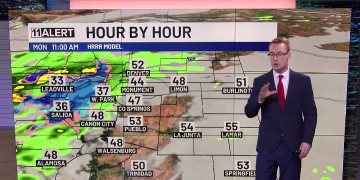
Increasing cloud cover and cool Monday.
Showers and storms possible in coming days.
Gradually warmer this week.
MONDAY: Increasing cloud cover with cool, upsloping winds from the east. Highs in the upper 50s and 60s. Showers and storms are possible west of I-25 with even a few snowflakes possible in Teller County later this afternoon. An isolated shower is also possible around Colorado Springs later today. More scattered showers are expected overnight.
TUESDAY: Partly cloudy, maybe an isolated shower or storm in the afternoon. Best opportunity this time appears to be over the Plains. Temperatures rise back into the 70s with gusty winds.
REST OF THE WEEK: Upper 70s and 80s Wednesday, a few degrees cooler for the rest of the week. We remain unsettled with isolated showers possible at

 BusinessDen
 The Pueblo Chieftain
 Law & Crime
 America News
 The Babylon Bee
 5 On Your Side Sports
 OK Magazine