
 WSAZ NewsChannel 3
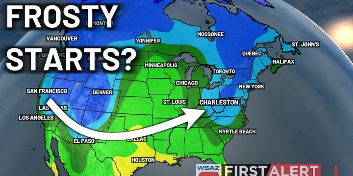
HUNTINGTON, W.Va. (WSAZ) - A strong area of Canadian high pressure will begin working into the area by the middle of the week. This will drive the development of a still northerly breeze over the area by Tuesday, becoming even stronger on Wednesday and Thursday.
The northerly breeze, combined with clear skies and dry conditions overhead will allow overnight lows to drop significantly by the time we reach the end of the week.
By Friday morning, we’ll be talking about temperatures in the upper 30s and lower 40s over the widespread area - temperatures that are definitely cool enough for some patchy frost here or there.
On tonight’s episode, we’ll be looking at how frost can form even in temperatures >32°, as well as some of the earliest and latest frosts we’ve seen.
Meanwhile, another col

 WBRC
WBRC Associated Press US News
 ClickOrlando
 KOLD Tucson
 CBS News
 Associated Press US and World News Video
 Raw Story
 E Online