
 WAKA Action 8 News
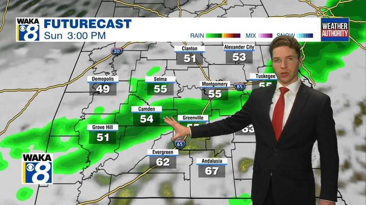
Saturday morning was cold and winter-like again, with lows in the upper 20s to low 30s area-wide. Temperatures remained cool despite some sunshine and dry weather Saturday. Highs were in the mid 50s to low 60s. Saturday night looks less cold than recent nights, thanks to increasing cloud-cover. Temperatures only fall into the 40s through Sunday morning.
Rain returns Sunday, though it may remain relatively light and scattered in nature throughout the day. Otherwise, Sunday looks like a gloomy day, with a mainly cloudy sky. High temperatures range from the 50s to low 60s at best. Sunday night remains cloudy, but trends drier and cooler as a cold front pushes through and southeast of our area.
Monday begins dry, but remains cloudy throughout the day. Temperatures remain cool, with highs in

 America News
 WCBI-TV
 Daily Voice
 WLOX
WLOX WABI
WABI 13 On Your Side
 WAND TV
 NBC10 Philadelphia
 IMDb Movies