
Stay weather aware Monday night into Tuesday morning; we have a wintry and wet mess heading our way as low pressure passes to our south. Expect increasing clouds Monday with highs in the upper 30s to low 40s. Moisture streams in overnight, and with slightly milder air coming with it, we'll see precipitation types stacked from north to south. The most likely area to see accumulating snow will stay along and north of I-64 with a general 1" to 3" possible, higher into northern counties. Farther south we'll see a brief mix (sleet & freezing rain) over to rain which will limit snowfall potential. A winter weather advisory is in effect for Bluegrass and northern counties. This will be our best chance at snow of the season for some, use caution on the roads late Monday night, the Tuesday morning
Wet and Wintry Weather Inbound Monday Night, Tuesday Morning
 LEX 18 News3 hrs ago
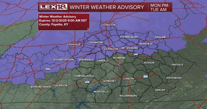
115

 WAKA Action 8 News
 WHNT News 19
 CBS 42
 America News
 Daily Voice
 WCBI-TV
 WLOX
WLOX WABI
WABI 13 On Your Side
 WAND TV
 Insider