
 WRCB-TV
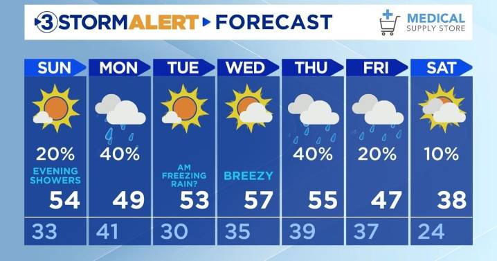
Happy Saturday, everyone!
Tonight's low will be 33 with clear skies. Winds will continue to be calm. Dense fog will form overnight making it more hazardous to travel. Visibility may be reduced to a fourth of a mile or less, so take your time to get to your destination, and do not use your brights.
Sunday will be warmer than today at 54 with mostly sunny skies. The low will be above freezing at 41. Rain showers are expected starting around 9:00 PM EST.
More rain showers will move in on Monday morning. Some flurries may be mixed in with these showers in the mountains. As the system moves east and temperatures drop, freezing rain will be possible in the mountains between Cherokee and Monroe counties. Not much accumulation is expected, but even a little bit of freezing rain can cause slick

 CBS 42
 WGNO
WGNO Queen City News
 WSMV 4 Nashville
 NewsChannel 5 Nashville
 WBIR Channel 10
 WVLT
WVLT Rolling Stone