
 The Bay City Times
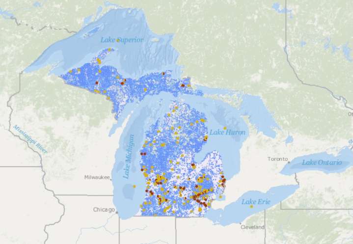
A new map aims to help Michigan anglers determine whether their fishing spot has an advisory for ‘forever chemicals.’
The new interactive mapping tool launched by the Great Lakes PFAS Action Network (GLPAN) compiles state data into a user-friendly visual tool to see which Michigan water bodies have a consumption advisory or a “Do Not Eat” warning for PFAS chemicals.
“As thousands of anglers head out to fish Michigan’s lakes, rivers and streams this winter, this tool serves as a critical resource to ensure people know if the fish they are catching are safe to eat,” said Anthony Spaniola, an attorney and GLPAN co-chair. “People shouldn’t have to comb through complicated government websites to figure that out.”
The map follows a significant expansion of state waterbodies with a PFAS con

 KPAX
KPAX The Daily Mining Gazette
 The Daily Mining Gazette Sports
 SI NBA
 Raw Story
 The Takeout
 WIRED
WIRED E Online